facebook
twitter
google plus
Linkedin
youtube
Orders over $100 ship FREE
800-338-6228
All Categories
alaska
Alaska (232)
alaska
Atlantic (255)
alaska
Great Lakes (134)
alaska
Gulf (160)
alaska
Pacific (213)
Search
$
0.00
0
Home
Shop for nautical charts
Customer Login
Show Cart
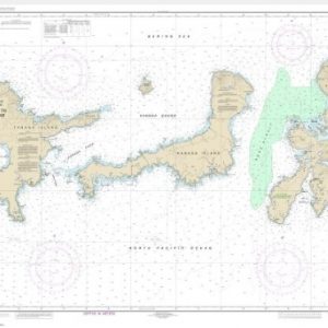
McClure and Stockton Islands and vicinity (chart 16046)
Home
Shop for nautical charts
Products
McClure and Stockton Islands and vicinity (chart 16046)
Home
/
Shop for nautical charts
/
Alaska
/ McClure and Stockton Islands and vicinity (chart 16046)
McClure and Stockton Islands and vicinity (chart 16046)
$
21.00
Nautical chart scale
: 1:50,204
$
Quantity
Add to cart
Chart ID:
16046
Category:
Alaska
Description
Additional information
Description
View this chart on the NOAA Chart viewer
Additional information
Weight
32 oz
Dimensions
42 × 4 × 4 in
Related products
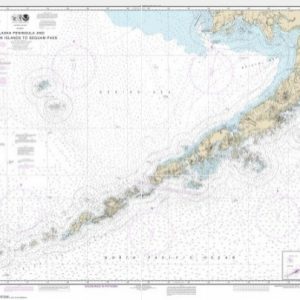
Alaska Peninsula and Aleutian Islands to Seguam Pass (chart 16011)
$
21.00
Select options
Agattu Island (chart 16434)
$
21.00
Select options
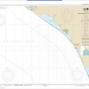
Alaska – West Coast. Delong Mountain Terminal (chart 16145)
$
21.00
Select options
facebook
twitter
google plus
Linkedin
youtube