• facebook
  • twitter
  • google plus
  • Linkedin
  • youtube
Orders over $100 ship FREE 800-338-6228
NOAA Charts
$0.00 0
  • Home
  • Shop for nautical charts
  • Customer Login
  • Show Cart

Category: Alaska

  • Home
  • Shop for nautical charts
  • Products
  • Alaska
  • Page 5
Home / Shop for nautical charts / Alaska / Page 5

Alaska

Showing 49–60 of 233 results

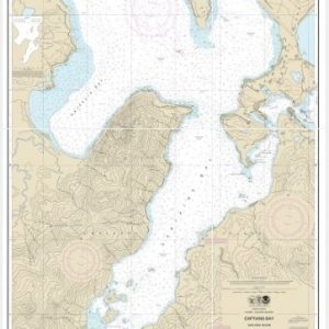
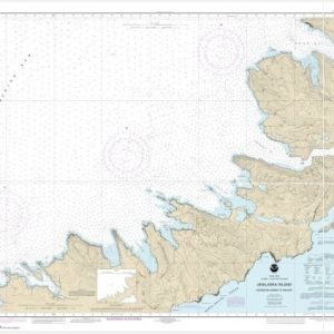
  • Captains Bay (chart 16530)

    $21.00
    Select options
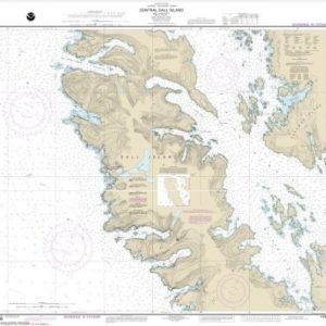
  • Central Dall Island and vicinity (chart 17408)

    $21.00
    Select options
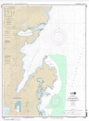
  • Charham Strait Ports Alexander, Conclusion, and Armstrong (chart 17331)

    $21.00
    Select options
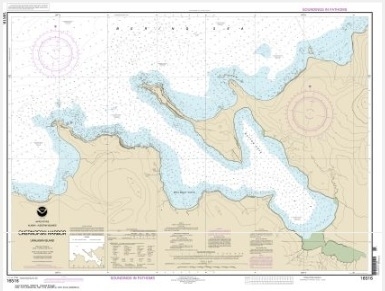
  • Chernofski Harbor (chart 16516)

    $21.00
    Select options
  • Chernofski Harbor to Skan Bay (chart 16515)

    $21.00
    Select options
  • Chiachi Island to Nagai Island;Chiachi Islands Anchorage (chart 16556)

    $21.00
    Select options
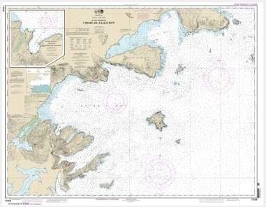
  • Chignik and Kujulik Bays, Alaska Pen.;Anchorage and Mud Bays, Chignik Bay (chart 16566)

    $21.00
    Select options
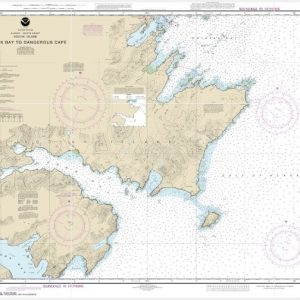
  • Chiniak Bay to Dangerous Cape (chart 16593)

    $21.00
    Select options
  • Clarence Strait and Moira Sound (chart 17432)

    $21.00
    Select options
  • Clarence Strait, Cholmondeley Sound and Skowl Arm (chart 17436)

    $21.00
    Select options
  • Placeholder

    Cold Bay and approaches, Alaska Pen.;King Cove Harbor (chart 16549)

    $21.00
    Select options
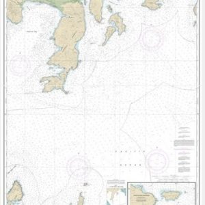
  • Constantine Harbor, Amchitka Island (chart 16446)

    $21.00
    Select options
  • ←
  • 1
  • 2
  • 3
  • 4
  • 5
  • 6
  • 7
  • 8
  • …
  • 18
  • 19
  • 20
  • →

Chartside Map Locators

Looking for a specific nautical chart?

Download these helpful chartside indexes to find the chart you're looking for quickly.

Regions

  • Alaska
  • Atlantic
  • Pacific
  • Great Lakes
  • Gulf

(all chartside files are PDF format and are very large, be patient during download on slow connections)

Contact Us

Feel free to contact us if you have any questions.

  • 8119 Central Ave.
    Capitol Heights, MD 20743
  • HBudd@whmap.com
  • 301-336-1143
  • 800-338-6228
  • 301-336-5520
  • http://whmap.com/

Map Production

We have the staff, software and equipment to handle all aspects of cartography and map production. Our large library of software titles can accommodate the processing and editing of any customer-provided final files.

We are also able to create new maps by utilizing files output from a GIS environment, integrating such data with accompanying text and graphics (photographs, logos, street indexes, tables, etc.) into a clean, publication-quality layout.

Long Term

Williams & Heintz Map Corporation has been printing maps for entrepreneurs, government agencies, and map publishers for over 93 years. We combine the highest quality pre-press, printing, and folding with industry leading knowledge and customer service.

Sustainable

Williams & Heintz understands the importance of building and maintaining a cleaner environment and aims to contribute in as many ways possible throughout our map production and printing cycle.

We are continuously improving elements in our map making and printing process to produce the same high quality custom maps with far less negative impact on the environment.

Versatile

At Williams & Heintz, we can assist you with any aspect of map production and manufacturing, from the simplest 1-color map to the most complicated 12-color map, from 3″ x 5″ to 47 ¼ ” x 63″. Send us your digital files, or films and camera copy.

We welcome your difficult reproduction problems and complex technical maps as well as simpler jobs. All will get the same care and attention to detail that maps require, at a competitive price.

  • facebook
  • twitter
  • google plus
  • Linkedin
  • youtube
© 2022 Williams & Heintz Map Corporation. All Rights Reserved.

Web Design by Solnet