• facebook
  • twitter
  • google plus
  • Linkedin
  • youtube
Orders over $100 ship FREE 800-338-6228
NOAA Charts
$0.00 0
  • Home
  • Shop for nautical charts
  • Customer Login
  • Show Cart

Category: Alaska

  • Home
  • Shop for nautical charts
  • Products
  • Alaska
  • Page 9
Home / Shop for nautical charts / Alaska / Page 9

Alaska

Showing 97–108 of 233 results

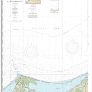
  • Icy Cape to Nokotlek Pt. (chart 16087)

    $21.00
    Select options
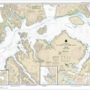
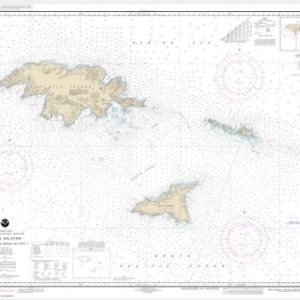
  • Icy Strait and Cross Sound;Inian Cove;Elfin Cove (chart 17302)

    $21.00
    Select options
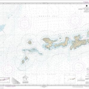
  • Igitkin ls. to Semisopochnoi Island (chart 16460)

    $21.00
    Select options
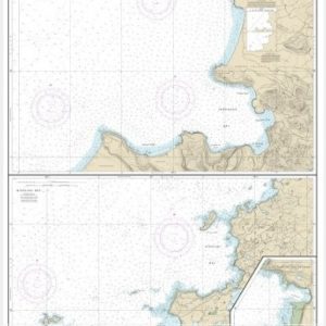
  • Inanudak Bay and Nikolski Bay, Umnak l.;River and Mueller Coves (chart 16511)

    $21.00
    Select options
  • Ingenstrem Rocks to Attu Island (chart 16421)

    $21.00
    Select options
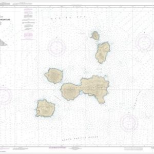
  • Islands of Four Mountains (chart 16501)

    $21.00
    Select options
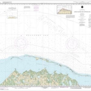
  • Jones Islands and approaches (chart 16062)

    $21.00
    Select options
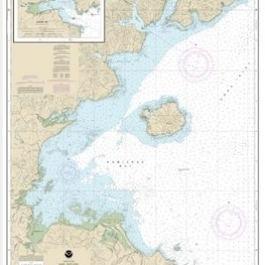
  • Kamishak Bay;lliamna Bay (chart 16648)

    $21.00
    Select options
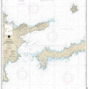
  • Kanaga Pass and approaches (chart 16463)

    $21.00
    Select options
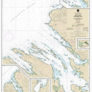
  • Kasaan Bay, Clarence Strait;Hollis Anchorage, eastern part;Lyman Anchorage (chart 17426)

    $21.00
    Select options
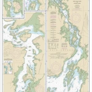
  • Keku Strait-Monte Carlo Island to Entrance Island;The Summit;Devils Elbow (chart 17372)

    $21.00
    Select options
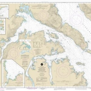
  • Keku Strait-northern part, including Saginaw and Security Bays and Port Camden;Kake Inset (chart 17368)

    $21.00
    Select options
  • ←
  • 1
  • 2
  • 3
  • …
  • 6
  • 7
  • 8
  • 9
  • 10
  • 11
  • 12
  • …
  • 18
  • 19
  • 20
  • →

Chartside Map Locators

Looking for a specific nautical chart?

Download these helpful chartside indexes to find the chart you're looking for quickly.

Regions

  • Alaska
  • Atlantic
  • Pacific
  • Great Lakes
  • Gulf

(all chartside files are PDF format and are very large, be patient during download on slow connections)

Contact Us

Feel free to contact us if you have any questions.

  • 8119 Central Ave.
    Capitol Heights, MD 20743
  • HBudd@whmap.com
  • 301-336-1143
  • 800-338-6228
  • 301-336-5520
  • http://whmap.com/

Map Production

We have the staff, software and equipment to handle all aspects of cartography and map production. Our large library of software titles can accommodate the processing and editing of any customer-provided final files.

We are also able to create new maps by utilizing files output from a GIS environment, integrating such data with accompanying text and graphics (photographs, logos, street indexes, tables, etc.) into a clean, publication-quality layout.

Long Term

Williams & Heintz Map Corporation has been printing maps for entrepreneurs, government agencies, and map publishers for over 93 years. We combine the highest quality pre-press, printing, and folding with industry leading knowledge and customer service.

Sustainable

Williams & Heintz understands the importance of building and maintaining a cleaner environment and aims to contribute in as many ways possible throughout our map production and printing cycle.

We are continuously improving elements in our map making and printing process to produce the same high quality custom maps with far less negative impact on the environment.

Versatile

At Williams & Heintz, we can assist you with any aspect of map production and manufacturing, from the simplest 1-color map to the most complicated 12-color map, from 3″ x 5″ to 47 ¼ ” x 63″. Send us your digital files, or films and camera copy.

We welcome your difficult reproduction problems and complex technical maps as well as simpler jobs. All will get the same care and attention to detail that maps require, at a competitive price.

  • facebook
  • twitter
  • google plus
  • Linkedin
  • youtube
© 2022 Williams & Heintz Map Corporation. All Rights Reserved.

Web Design by Solnet