• facebook
  • twitter
  • google plus
  • Linkedin
  • youtube
Orders over $100 ship FREE 800-338-6228
NOAA Charts
$0.00 0
  • Home
  • Shop for nautical charts
  • Customer Login
  • Show Cart

Category: Atlantic

  • Home
  • Shop for nautical charts
  • Products
  • Atlantic
  • Page 12
Home / Shop for nautical charts / Atlantic / Page 12

Atlantic

Showing 133–144 of 256 results

  • Jamaica Bay and Rockaway Inlet (chart 12350)

    $21.00
    Select options
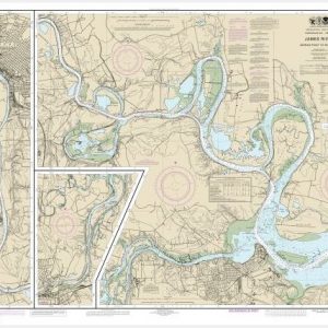
  • James River Jamestown Island to Jordan Point (chart 12251)

    $21.00
    Select options
  • James River Jordan Point to Richmond (chart 12252)

    $21.00
    Select options
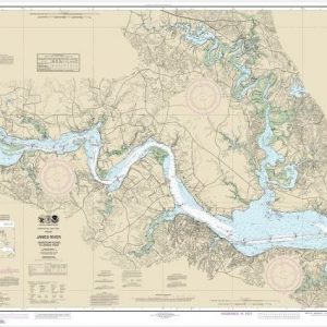
  • James River Newport News to Jamestown Island; Back River and College Creek (chart 12248)

    $21.00
    Select options
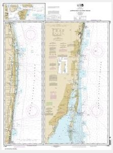
  • Jupiter Inlet to Fowey Rocks;Lake Worth Inlet (chart 11466)

    $21.00
    Select options
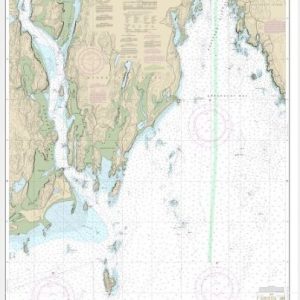
  • Kennebec and Sheepscot River Entrances (chart 13295)

    $21.00
    Select options
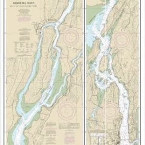
  • Kennebec River Bath to Courthouse Point (chart 13298)

    $21.00
    Select options
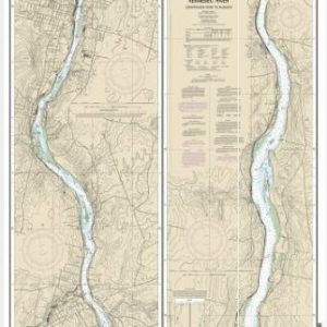
  • Kennebec River Courthouse Point to Augusta (chart 13297)

    $21.00
    Select options
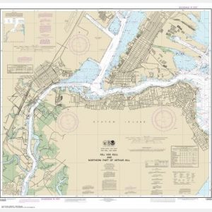
  • Kill Van Kull and Northern Part of Arthur Kill (Inset) (chart 12333)

    $21.00
    Select options
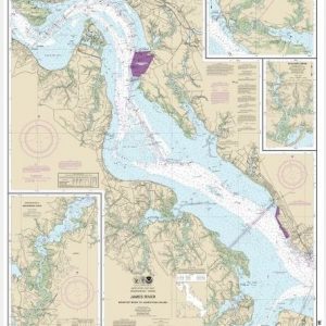
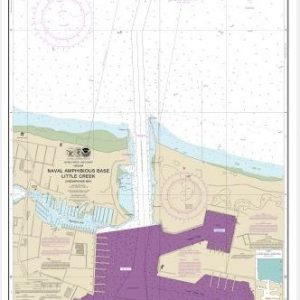
  • Little Creek Naval Amphibous Base (chart 12255)

    $21.00
    Select options
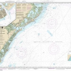
  • Little Egg Inlet to Hereford Inlet;Absecon Inlet (chart 12318)

    $21.00
    Select options
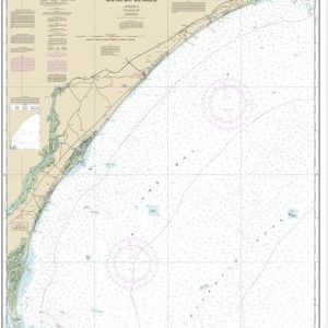
  • Little River lnlet to Winyah Bay Entrance (chart 11535)

    $21.00
    Select options
  • ←
  • 1
  • 2
  • 3
  • …
  • 9
  • 10
  • 11
  • 12
  • 13
  • 14
  • 15
  • …
  • 20
  • 21
  • 22
  • →

Chartside Map Locators

Looking for a specific nautical chart?

Download these helpful chartside indexes to find the chart you're looking for quickly.

Regions

  • Alaska
  • Atlantic
  • Pacific
  • Great Lakes
  • Gulf

(all chartside files are PDF format and are very large, be patient during download on slow connections)

Contact Us

Feel free to contact us if you have any questions.

  • 8119 Central Ave.
    Capitol Heights, MD 20743
  • HBudd@whmap.com
  • 301-336-1143
  • 800-338-6228
  • 301-336-5520
  • http://whmap.com/

Map Production

We have the staff, software and equipment to handle all aspects of cartography and map production. Our large library of software titles can accommodate the processing and editing of any customer-provided final files.

We are also able to create new maps by utilizing files output from a GIS environment, integrating such data with accompanying text and graphics (photographs, logos, street indexes, tables, etc.) into a clean, publication-quality layout.

Long Term

Williams & Heintz Map Corporation has been printing maps for entrepreneurs, government agencies, and map publishers for over 93 years. We combine the highest quality pre-press, printing, and folding with industry leading knowledge and customer service.

Sustainable

Williams & Heintz understands the importance of building and maintaining a cleaner environment and aims to contribute in as many ways possible throughout our map production and printing cycle.

We are continuously improving elements in our map making and printing process to produce the same high quality custom maps with far less negative impact on the environment.

Versatile

At Williams & Heintz, we can assist you with any aspect of map production and manufacturing, from the simplest 1-color map to the most complicated 12-color map, from 3″ x 5″ to 47 ¼ ” x 63″. Send us your digital files, or films and camera copy.

We welcome your difficult reproduction problems and complex technical maps as well as simpler jobs. All will get the same care and attention to detail that maps require, at a competitive price.

  • facebook
  • twitter
  • google plus
  • Linkedin
  • youtube
© 2022 Williams & Heintz Map Corporation. All Rights Reserved.

Web Design by Solnet