• facebook
  • twitter
  • google plus
  • Linkedin
  • youtube
Orders over $100 ship FREE 800-338-6228
NOAA Charts
$0.00 0
  • Home
  • Shop for nautical charts
  • Customer Login
  • Show Cart

Category: Atlantic

  • Home
  • Shop for nautical charts
  • Products
  • Atlantic
  • Page 15
Home / Shop for nautical charts / Atlantic / Page 15

Atlantic

Showing 169–180 of 256 results

  • New River;Jacksonville (chart 11542)

    $21.00
    Select options
  • New York Harbor (chart 12327)

    $21.00
    Select options
  • New York Harbor Upper Bay and Narrows-Anchorage Chart (chart 12334)

    $21.00
    Select options
  • New York Long Island, Shelter Island Sound and Peconic Bays;Mattituck Inlet (chart 12358)

    $21.00
    Select options
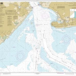
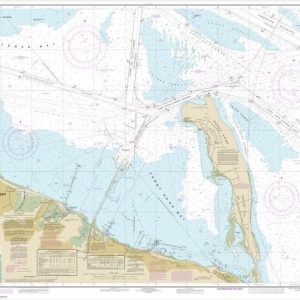
  • New York Lower Bay Northern part (chart 12402)

    $21.00
    Select options
  • New York Lower Bay Southern part (chart 12401)

    $21.00
    Select options
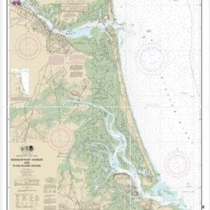
  • Newburyport Harbor and Plum Island Sound (chart 13282)

    $21.00
    Select options
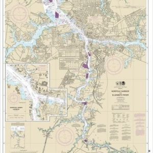
  • Norfolk Harbor and Elizabeth River (chart 12253)

    $21.00
    Select options
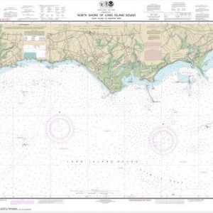
  • North Shore of Long Island Sound Duck Island to Madison Reef (chart 12374)

    $21.00
    Select options
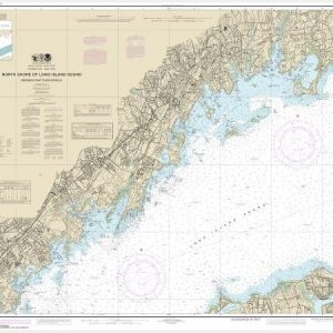
  • North Shore of Long Island Sound Greenwich Point to New Rochelle (chart 12367)

    $21.00
    Select options
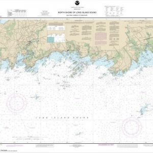
  • North Shore of Long Island Sound Guilford Harbor to Farm River (chart 12373)

    $21.00
    Select options
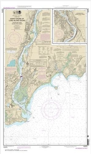
  • North Shore of Long Island Sound Housatonic River and Milford Harbor (chart 12370)

    $21.00
    Select options
  • ←
  • 1
  • 2
  • 3
  • …
  • 12
  • 13
  • 14
  • 15
  • 16
  • 17
  • 18
  • …
  • 20
  • 21
  • 22
  • →

Chartside Map Locators

Looking for a specific nautical chart?

Download these helpful chartside indexes to find the chart you're looking for quickly.

Regions

  • Alaska
  • Atlantic
  • Pacific
  • Great Lakes
  • Gulf

(all chartside files are PDF format and are very large, be patient during download on slow connections)

Contact Us

Feel free to contact us if you have any questions.

  • 8119 Central Ave.
    Capitol Heights, MD 20743
  • HBudd@whmap.com
  • 301-336-1143
  • 800-338-6228
  • 301-336-5520
  • http://whmap.com/

Map Production

We have the staff, software and equipment to handle all aspects of cartography and map production. Our large library of software titles can accommodate the processing and editing of any customer-provided final files.

We are also able to create new maps by utilizing files output from a GIS environment, integrating such data with accompanying text and graphics (photographs, logos, street indexes, tables, etc.) into a clean, publication-quality layout.

Long Term

Williams & Heintz Map Corporation has been printing maps for entrepreneurs, government agencies, and map publishers for over 93 years. We combine the highest quality pre-press, printing, and folding with industry leading knowledge and customer service.

Sustainable

Williams & Heintz understands the importance of building and maintaining a cleaner environment and aims to contribute in as many ways possible throughout our map production and printing cycle.

We are continuously improving elements in our map making and printing process to produce the same high quality custom maps with far less negative impact on the environment.

Versatile

At Williams & Heintz, we can assist you with any aspect of map production and manufacturing, from the simplest 1-color map to the most complicated 12-color map, from 3″ x 5″ to 47 ¼ ” x 63″. Send us your digital files, or films and camera copy.

We welcome your difficult reproduction problems and complex technical maps as well as simpler jobs. All will get the same care and attention to detail that maps require, at a competitive price.

  • facebook
  • twitter
  • google plus
  • Linkedin
  • youtube
© 2022 Williams & Heintz Map Corporation. All Rights Reserved.

Web Design by Solnet