• facebook
  • twitter
  • google plus
  • Linkedin
  • youtube
Orders over $100 ship FREE 800-338-6228
NOAA Charts
$0.00 0
  • Home
  • Shop for nautical charts
  • Customer Login
  • Show Cart

Category: Atlantic

  • Home
  • Shop for nautical charts
  • Products
  • Atlantic
  • Page 17
Home / Shop for nautical charts / Atlantic / Page 17

Atlantic

Showing 193–204 of 256 results

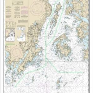
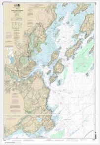
  • Penobscot Bay and Approaches (chart 13302)

    $21.00
    Select options
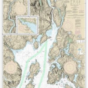
  • Penobscot Bay;Carvers Harbor and Approaches (chart 13305)

    $21.00
    Select options
  • Penobscot River;Belfast Harbor (chart 13309)

    $21.00
    Select options
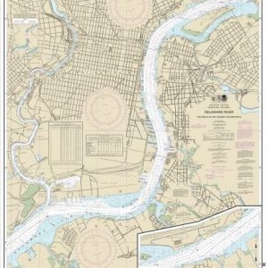
  • Philadelphia and Camden Waterfronts (chart 12313)

    $21.00
    Select options
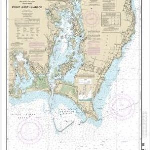
  • Point Judith Harbor (chart 13219)

    $21.00
    Select options
  • Ponce de Leon Inlet to Cape Canaveral (chart 11484)

    $21.00
    Select options
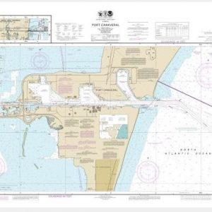
  • Port Canaveral;Canaveral Barge Canal Extension (chart 11478)

    $21.00
    Select options
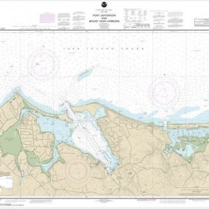
  • Port Jefferson and Mount Sinai Harbors (chart 12362)

    $21.00
    Select options
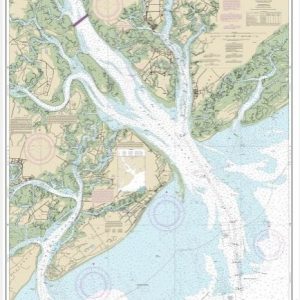
  • Port Royal Sound and Inland Passages (chart 11516)

    $21.00
    Select options
  • Portland Harbor and Vicinity (chart 13292)

    $21.00
    Select options
  • Portsmouth Harbor Cape Neddick Harbor to Isles of Shoals; Portsmouth Harbor (chart 13283)

    $21.00
    Select options
  • Portsmouth Harbor to Boston Harbor; Merrimack River Extension (chart 13274)

    $21.00
    Select options
  • ←
  • 1
  • 2
  • 3
  • …
  • 14
  • 15
  • 16
  • 17
  • 18
  • 19
  • 20
  • 21
  • 22
  • →

Chartside Map Locators

Looking for a specific nautical chart?

Download these helpful chartside indexes to find the chart you're looking for quickly.

Regions

  • Alaska
  • Atlantic
  • Pacific
  • Great Lakes
  • Gulf

(all chartside files are PDF format and are very large, be patient during download on slow connections)

Contact Us

Feel free to contact us if you have any questions.

  • 8119 Central Ave.
    Capitol Heights, MD 20743
  • HBudd@whmap.com
  • 301-336-1143
  • 800-338-6228
  • 301-336-5520
  • http://whmap.com/

Map Production

We have the staff, software and equipment to handle all aspects of cartography and map production. Our large library of software titles can accommodate the processing and editing of any customer-provided final files.

We are also able to create new maps by utilizing files output from a GIS environment, integrating such data with accompanying text and graphics (photographs, logos, street indexes, tables, etc.) into a clean, publication-quality layout.

Long Term

Williams & Heintz Map Corporation has been printing maps for entrepreneurs, government agencies, and map publishers for over 93 years. We combine the highest quality pre-press, printing, and folding with industry leading knowledge and customer service.

Sustainable

Williams & Heintz understands the importance of building and maintaining a cleaner environment and aims to contribute in as many ways possible throughout our map production and printing cycle.

We are continuously improving elements in our map making and printing process to produce the same high quality custom maps with far less negative impact on the environment.

Versatile

At Williams & Heintz, we can assist you with any aspect of map production and manufacturing, from the simplest 1-color map to the most complicated 12-color map, from 3″ x 5″ to 47 ¼ ” x 63″. Send us your digital files, or films and camera copy.

We welcome your difficult reproduction problems and complex technical maps as well as simpler jobs. All will get the same care and attention to detail that maps require, at a competitive price.

  • facebook
  • twitter
  • google plus
  • Linkedin
  • youtube
© 2022 Williams & Heintz Map Corporation. All Rights Reserved.

Web Design by Solnet