• facebook
  • twitter
  • google plus
  • Linkedin
  • youtube
Orders over $100 ship FREE 800-338-6228
NOAA Charts
$0.00 0
  • Home
  • Shop for nautical charts
  • Customer Login
  • Show Cart

Category: Atlantic

  • Home
  • Shop for nautical charts
  • Products
  • Atlantic
  • Page 18
Home / Shop for nautical charts / Atlantic / Page 18

Atlantic

Showing 205–216 of 256 results

  • Portsmouth Island to Beaufort, Including Cape Lookout Shoals (chart 11544)

    $21.00
    Select options
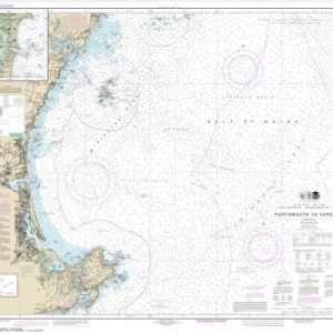
  • Portsmouth to Cape Ann; Hampton Harbor (chart 13278)

    $21.00
    Select options
  • Portsmouth to Dover and Exeter (chart 13285)

    $21.00
    Select options
  • Potomac River Chesapeake Bay to Piney Point (chart 12233)

    $21.00
    Select options
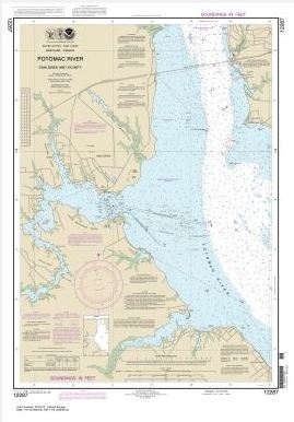
  • Potomac River Dahlgren and Vicinity (chart 12287)

    $21.00
    Select options
  • Potomac River Lower Cedar Point to Mattawoman Creek (chart 12288)

    $21.00
    Select options
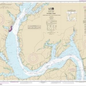
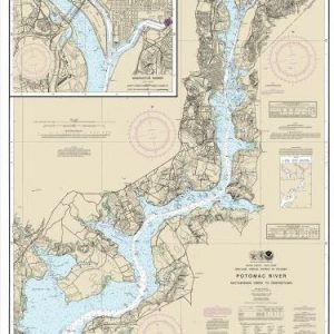
  • Potomac River Mattawoman Creek to Georgetown;Washington Harbor (chart 12289)

    $21.00
    Select options
  • Potomac River Piney Point to Lower Cedar Point (chart 12286)

    $21.00
    Select options
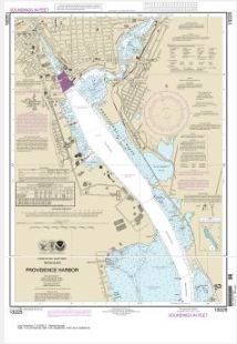
  • Providence Harbor (chart 13225)

    $21.00
    Select options
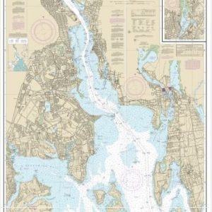
  • Providence River and Head of Narragansett Bay (chart 13224)

    $21.00
    Select options
  • Provincetown Harbor (chart 13249)

    $21.00
    Select options
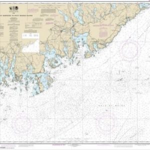
  • Quoddy Narrows to Petit Manan lsland (chart 13325)

    $21.00
    Select options
  • ←
  • 1
  • 2
  • 3
  • …
  • 15
  • 16
  • 17
  • 18
  • 19
  • 20
  • 21
  • 22
  • →

Chartside Map Locators

Looking for a specific nautical chart?

Download these helpful chartside indexes to find the chart you're looking for quickly.

Regions

  • Alaska
  • Atlantic
  • Pacific
  • Great Lakes
  • Gulf

(all chartside files are PDF format and are very large, be patient during download on slow connections)

Contact Us

Feel free to contact us if you have any questions.

  • 8119 Central Ave.
    Capitol Heights, MD 20743
  • HBudd@whmap.com
  • 301-336-1143
  • 800-338-6228
  • 301-336-5520
  • http://whmap.com/

Map Production

We have the staff, software and equipment to handle all aspects of cartography and map production. Our large library of software titles can accommodate the processing and editing of any customer-provided final files.

We are also able to create new maps by utilizing files output from a GIS environment, integrating such data with accompanying text and graphics (photographs, logos, street indexes, tables, etc.) into a clean, publication-quality layout.

Long Term

Williams & Heintz Map Corporation has been printing maps for entrepreneurs, government agencies, and map publishers for over 93 years. We combine the highest quality pre-press, printing, and folding with industry leading knowledge and customer service.

Sustainable

Williams & Heintz understands the importance of building and maintaining a cleaner environment and aims to contribute in as many ways possible throughout our map production and printing cycle.

We are continuously improving elements in our map making and printing process to produce the same high quality custom maps with far less negative impact on the environment.

Versatile

At Williams & Heintz, we can assist you with any aspect of map production and manufacturing, from the simplest 1-color map to the most complicated 12-color map, from 3″ x 5″ to 47 ¼ ” x 63″. Send us your digital files, or films and camera copy.

We welcome your difficult reproduction problems and complex technical maps as well as simpler jobs. All will get the same care and attention to detail that maps require, at a competitive price.

  • facebook
  • twitter
  • google plus
  • Linkedin
  • youtube
© 2022 Williams & Heintz Map Corporation. All Rights Reserved.

Web Design by Solnet