• facebook
  • twitter
  • google plus
  • Linkedin
  • youtube
Orders over $100 ship FREE 800-338-6228
NOAA Charts
$0.00 0
  • Home
  • Shop for nautical charts
  • Customer Login
  • Show Cart

Category: Great Lakes

  • Home
  • Shop for nautical charts
  • Products
  • Great Lakes
Home / Shop for nautical charts / Great Lakes

Great Lakes

Showing 1–12 of 135 results

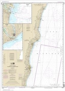
  • Algoma to Sheboygan;Kewaunee;Two Rivers (chart 14903)

    $21.00
    Select options
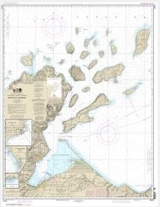
  • Apostle Islands, including Chequamegan Bay; Bayfield Harbor;Pikes Bay Harbor;La Pointe Harbor (chart 14973)

    $21.00
    Select options
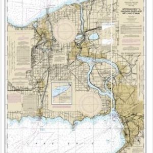
  • Approaches to Nigara River and Welland Canal (chart 14822)

    $21.00
    Select options
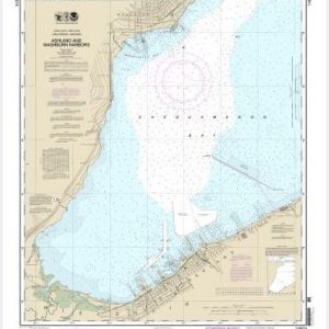
  • Ashland and Washburn harbors (chart 14974)

    $21.00
    Select options
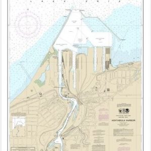
  • Ashtabula Harbor (chart 14836)

    $21.00
    Select options
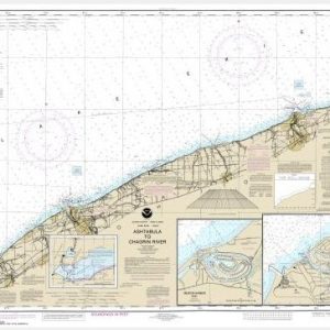
  • Ashtabula to Chagrin River;Mentor Harbor;Chagrin River (chart 14825)

    $21.00
    Select options
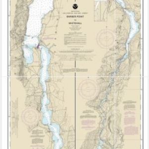
  • Barber Point to Whitehall (chart 14784)

    $21.00
    Select options
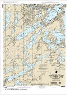
  • Basswood Lake, Eastern Part (chart 14987)

    $21.00
    Select options
  • Basswood Lake, Western Part (chart 14988)

    $21.00
    Select options
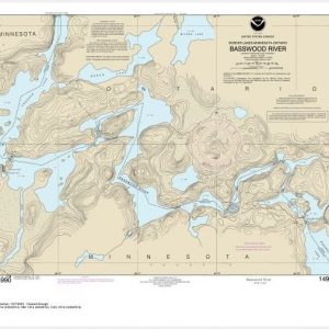
  • Basswood River (chart 14990)

    $21.00
    Select options
  • Beaver Bay to Pigeon Point;Silver Bay Harbor;Taconite Harbor;Grand Marais Harbor (chart 14967)

    $21.00
    Select options
  • Big Bay Point to Redridge;Grand Traverse Bay Harbor;Lac La Belle harbor;Copper and Eagle Harbors (chart 14964)

    $21.00
    Select options
  • 1
  • 2
  • 3
  • 4
  • …
  • 10
  • 11
  • 12
  • →

Chartside Map Locators

Looking for a specific nautical chart?

Download these helpful chartside indexes to find the chart you're looking for quickly.

Regions

  • Alaska
  • Atlantic
  • Pacific
  • Great Lakes
  • Gulf

(all chartside files are PDF format and are very large, be patient during download on slow connections)

Contact Us

Feel free to contact us if you have any questions.

  • 8119 Central Ave.
    Capitol Heights, MD 20743
  • HBudd@whmap.com
  • 301-336-1143
  • 800-338-6228
  • 301-336-5520
  • http://whmap.com/

Map Production

We have the staff, software and equipment to handle all aspects of cartography and map production. Our large library of software titles can accommodate the processing and editing of any customer-provided final files.

We are also able to create new maps by utilizing files output from a GIS environment, integrating such data with accompanying text and graphics (photographs, logos, street indexes, tables, etc.) into a clean, publication-quality layout.

Long Term

Williams & Heintz Map Corporation has been printing maps for entrepreneurs, government agencies, and map publishers for over 93 years. We combine the highest quality pre-press, printing, and folding with industry leading knowledge and customer service.

Sustainable

Williams & Heintz understands the importance of building and maintaining a cleaner environment and aims to contribute in as many ways possible throughout our map production and printing cycle.

We are continuously improving elements in our map making and printing process to produce the same high quality custom maps with far less negative impact on the environment.

Versatile

At Williams & Heintz, we can assist you with any aspect of map production and manufacturing, from the simplest 1-color map to the most complicated 12-color map, from 3″ x 5″ to 47 ¼ ” x 63″. Send us your digital files, or films and camera copy.

We welcome your difficult reproduction problems and complex technical maps as well as simpler jobs. All will get the same care and attention to detail that maps require, at a competitive price.

  • facebook
  • twitter
  • google plus
  • Linkedin
  • youtube
© 2022 Williams & Heintz Map Corporation. All Rights Reserved.

Web Design by Solnet