• facebook
  • twitter
  • google plus
  • Linkedin
  • youtube
Orders over $100 ship FREE 800-338-6228
NOAA Charts
$0.00 0
  • Home
  • Shop for nautical charts
  • Customer Login
  • Show Cart

Category: Great Lakes

  • Home
  • Shop for nautical charts
  • Products
  • Great Lakes
  • Page 10
Home / Shop for nautical charts / Great Lakes / Page 10

Great Lakes

Showing 109–120 of 135 results

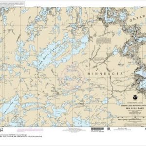
  • Sea Gull Lake (chart 14984)

    $21.00
    Select options
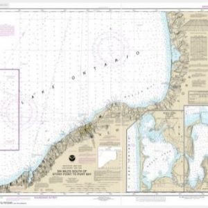
  • Six Miles south of Stony Point to Port Bay;North Pond;Little Sodus Bay (chart 14803)

    $21.00
    Select options
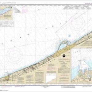
  • Sixteenmile Creek to Conneaut;Conneaut Harbor (chart 14824)

    $21.00
    Select options
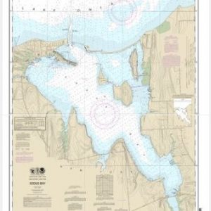
  • Sodus Bay (chart 14814)

    $21.00
    Select options
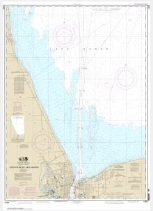
  • South End of Lake Huron (chart 14865)

    $21.00
    Select options
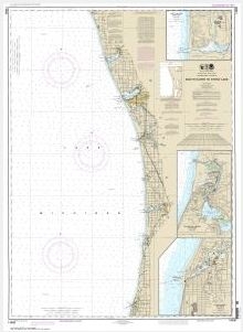
  • South Haven to Stony Lake;South Haven;Port Sheldon;Saugatuck Harbor (chart 14906) South Haven to Stony Lake;South Haven;Port Sheldon;Saugatuck Harbor (chart 14906)

    $21.00
    Select options
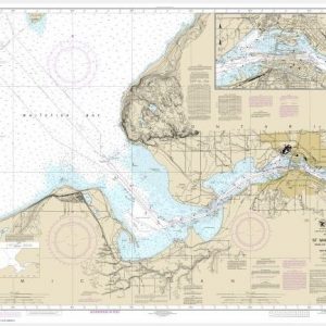
  • St Marys River – Neebish Island (chart 14887)

    $21.00
    Select options
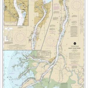
  • St. Clair River;Head of St. Clair River (chart 14852)

    $21.00
    Select options
  • St. Joseph and Benton Harbor (chart 14930)

    $21.00
    Select options
  • St. Marys River – Detour Passage to Munuscong Lake;Detour Passage (chart 14882)

    $21.00
    Select options
  • St. Marys River – Head of Lake Nicolet to Whitefish Bay;Sault Ste. Marie (chart 14884)

    $21.00
    Select options
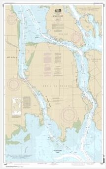
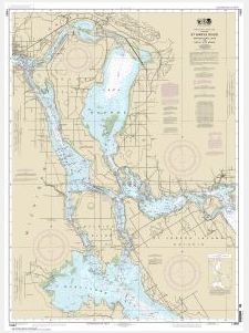
  • St. Marys River – Munuscong Lake to Sault Ste. Marie (chart 14883)

    $21.00
    Select options
  • ←
  • 1
  • 2
  • 3
  • …
  • 7
  • 8
  • 9
  • 10
  • 11
  • 12
  • →

Chartside Map Locators

Looking for a specific nautical chart?

Download these helpful chartside indexes to find the chart you're looking for quickly.

Regions

  • Alaska
  • Atlantic
  • Pacific
  • Great Lakes
  • Gulf

(all chartside files are PDF format and are very large, be patient during download on slow connections)

Contact Us

Feel free to contact us if you have any questions.

  • 8119 Central Ave.
    Capitol Heights, MD 20743
  • HBudd@whmap.com
  • 301-336-1143
  • 800-338-6228
  • 301-336-5520
  • http://whmap.com/

Map Production

We have the staff, software and equipment to handle all aspects of cartography and map production. Our large library of software titles can accommodate the processing and editing of any customer-provided final files.

We are also able to create new maps by utilizing files output from a GIS environment, integrating such data with accompanying text and graphics (photographs, logos, street indexes, tables, etc.) into a clean, publication-quality layout.

Long Term

Williams & Heintz Map Corporation has been printing maps for entrepreneurs, government agencies, and map publishers for over 93 years. We combine the highest quality pre-press, printing, and folding with industry leading knowledge and customer service.

Sustainable

Williams & Heintz understands the importance of building and maintaining a cleaner environment and aims to contribute in as many ways possible throughout our map production and printing cycle.

We are continuously improving elements in our map making and printing process to produce the same high quality custom maps with far less negative impact on the environment.

Versatile

At Williams & Heintz, we can assist you with any aspect of map production and manufacturing, from the simplest 1-color map to the most complicated 12-color map, from 3″ x 5″ to 47 ¼ ” x 63″. Send us your digital files, or films and camera copy.

We welcome your difficult reproduction problems and complex technical maps as well as simpler jobs. All will get the same care and attention to detail that maps require, at a competitive price.

  • facebook
  • twitter
  • google plus
  • Linkedin
  • youtube
© 2022 Williams & Heintz Map Corporation. All Rights Reserved.

Web Design by Solnet