• facebook
  • twitter
  • google plus
  • Linkedin
  • youtube
Orders over $100 ship FREE 800-338-6228
NOAA Charts
$0.00 0
  • Home
  • Shop for nautical charts
  • Customer Login
  • Show Cart

Category: Gulf

  • Home
  • Shop for nautical charts
  • Products
  • Gulf
  • Page 10
Home / Shop for nautical charts / Gulf / Page 10

Gulf

Showing 109–120 of 161 results

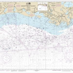
  • Mississippi River to Galveston (chart 11340)

    $21.00
    Select options
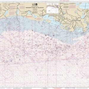
  • Mississippi River to Galveston (Oil and Gas Leasing Areas)

    $21.00
    Select options
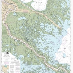
  • Mississippi River-New Orleans to Baton Rouge (chart 11370)

    $21.00
    Select options
  • Mississippi River-Venice to New Orleans (chart 11364)

    $21.00
    Select options
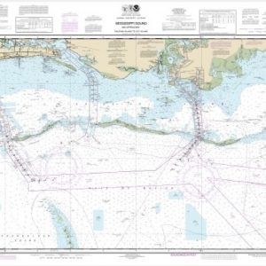
  • Mississippi Sound and approaches Dauphin Island to Cat Island (chart 11373)

    $21.00
    Select options
  • Mobile Bay Approaches and Lower Half (chart 11377)

    $21.00
    Select options
  • Mobile Bay East Fowl River to Deer River Pt; Mobile Middle Bay Terminal (chart 11380)

    $21.00
    Select options
  • Mobile Bay Mobile Ship Channel-Northern End (chart 11376)

    $21.00
    Select options
  • Navassa Island (Metric) (chart 26194)

    $21.00
    Select options
  • New Orleans Harbor Chalmette Slip to Southport (chart 11368)

    $21.00
    Select options
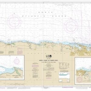
  • North Coast of Puerto Rico Punta Penon to Punta Vacia Talega;Puerto Arecibo;Puerto Palmas Altas (chart 25668)

    $21.00
    Select options
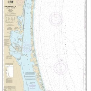
  • Northern part of Laguna Madre (chart 11304)

    $21.00
    Select options
  • ←
  • 1
  • 2
  • 3
  • …
  • 7
  • 8
  • 9
  • 10
  • 11
  • 12
  • 13
  • 14
  • →

Chartside Map Locators

Looking for a specific nautical chart?

Download these helpful chartside indexes to find the chart you're looking for quickly.

Regions

  • Alaska
  • Atlantic
  • Pacific
  • Great Lakes
  • Gulf

(all chartside files are PDF format and are very large, be patient during download on slow connections)

Contact Us

Feel free to contact us if you have any questions.

  • 8119 Central Ave.
    Capitol Heights, MD 20743
  • HBudd@whmap.com
  • 301-336-1143
  • 800-338-6228
  • 301-336-5520
  • http://whmap.com/

Map Production

We have the staff, software and equipment to handle all aspects of cartography and map production. Our large library of software titles can accommodate the processing and editing of any customer-provided final files.

We are also able to create new maps by utilizing files output from a GIS environment, integrating such data with accompanying text and graphics (photographs, logos, street indexes, tables, etc.) into a clean, publication-quality layout.

Long Term

Williams & Heintz Map Corporation has been printing maps for entrepreneurs, government agencies, and map publishers for over 93 years. We combine the highest quality pre-press, printing, and folding with industry leading knowledge and customer service.

Sustainable

Williams & Heintz understands the importance of building and maintaining a cleaner environment and aims to contribute in as many ways possible throughout our map production and printing cycle.

We are continuously improving elements in our map making and printing process to produce the same high quality custom maps with far less negative impact on the environment.

Versatile

At Williams & Heintz, we can assist you with any aspect of map production and manufacturing, from the simplest 1-color map to the most complicated 12-color map, from 3″ x 5″ to 47 ¼ ” x 63″. Send us your digital files, or films and camera copy.

We welcome your difficult reproduction problems and complex technical maps as well as simpler jobs. All will get the same care and attention to detail that maps require, at a competitive price.

  • facebook
  • twitter
  • google plus
  • Linkedin
  • youtube
© 2022 Williams & Heintz Map Corporation. All Rights Reserved.

Web Design by Solnet