• facebook
  • twitter
  • google plus
  • Linkedin
  • youtube
Orders over $100 ship FREE 800-338-6228
NOAA Charts
$0.00 0
  • Home
  • Shop for nautical charts
  • Customer Login
  • Show Cart

Category: Pacific

  • Home
  • Shop for nautical charts
  • Products
  • Pacific
Home / Shop for nautical charts / Pacific

Pacific

Showing 1–12 of 214 results

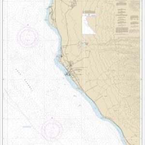
  • Albion to Caspar (chart 18628)

    $21.00
    Select options
  • Anacapa Passage;Prisoners Harbor (chart 18729)

    $21.00
    Select options
  • Anacortes to Skagit Bay (chart 18427)

    $21.00
    Select options
  • Approaches to Admirally Inlet Dungeness to Oak Bay (chart 18471)

    $21.00
    Select options
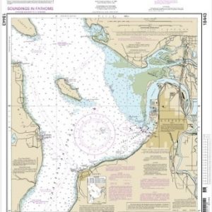
  • Approaches to Everett (chart 18443)

    $21.00
    Select options
  • Approaches to Lahaina, Island of Maui (chart 19348)

    $21.00
    Select options
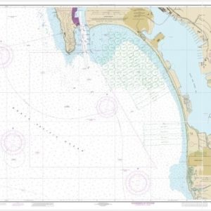
  • Approaches to San Diego Bay (chart 18772)

    $21.00
    Select options
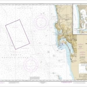
  • Approaches to San Diego Bay;Mission Bay (chart 18765)

    $21.00
    Select options
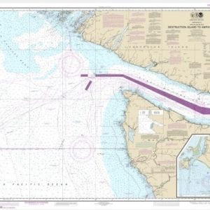
  • Approaches to Strait of Juan de Fuca Destruction lsland to Amphitrite Point (chart 18480)

    $21.00
    Select options
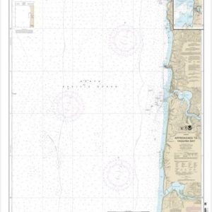
  • Approaches to Yaquina Bay;Depoe Bay (chart 18561)

    $21.00
    Select options
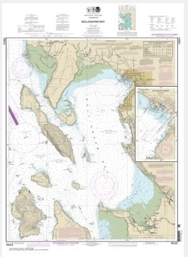
  • Bellingham Bay; Bellingham Harbor (chart 18424)

    $21.00
    Select options
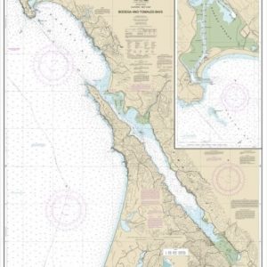
  • Bodega and Tomales Bays;Bodega Harbor (chart 18643)

    $21.00
    Select options
  • 1
  • 2
  • 3
  • 4
  • …
  • 16
  • 17
  • 18
  • →

Chartside Map Locators

Looking for a specific nautical chart?

Download these helpful chartside indexes to find the chart you're looking for quickly.

Regions

  • Alaska
  • Atlantic
  • Pacific
  • Great Lakes
  • Gulf

(all chartside files are PDF format and are very large, be patient during download on slow connections)

Contact Us

Feel free to contact us if you have any questions.

  • 8119 Central Ave.
    Capitol Heights, MD 20743
  • HBudd@whmap.com
  • 301-336-1143
  • 800-338-6228
  • 301-336-5520
  • http://whmap.com/

Map Production

We have the staff, software and equipment to handle all aspects of cartography and map production. Our large library of software titles can accommodate the processing and editing of any customer-provided final files.

We are also able to create new maps by utilizing files output from a GIS environment, integrating such data with accompanying text and graphics (photographs, logos, street indexes, tables, etc.) into a clean, publication-quality layout.

Long Term

Williams & Heintz Map Corporation has been printing maps for entrepreneurs, government agencies, and map publishers for over 93 years. We combine the highest quality pre-press, printing, and folding with industry leading knowledge and customer service.

Sustainable

Williams & Heintz understands the importance of building and maintaining a cleaner environment and aims to contribute in as many ways possible throughout our map production and printing cycle.

We are continuously improving elements in our map making and printing process to produce the same high quality custom maps with far less negative impact on the environment.

Versatile

At Williams & Heintz, we can assist you with any aspect of map production and manufacturing, from the simplest 1-color map to the most complicated 12-color map, from 3″ x 5″ to 47 ¼ ” x 63″. Send us your digital files, or films and camera copy.

We welcome your difficult reproduction problems and complex technical maps as well as simpler jobs. All will get the same care and attention to detail that maps require, at a competitive price.

  • facebook
  • twitter
  • google plus
  • Linkedin
  • youtube
© 2022 Williams & Heintz Map Corporation. All Rights Reserved.

Web Design by Solnet