• facebook
  • twitter
  • google plus
  • Linkedin
  • youtube
Orders over $100 ship FREE 800-338-6228
NOAA Charts
$0.00 0
  • Home
  • Shop for nautical charts
  • Customer Login
  • Show Cart

Category: Pacific

  • Home
  • Shop for nautical charts
  • Products
  • Pacific
  • Page 14
Home / Shop for nautical charts / Pacific / Page 14

Pacific

Showing 157–168 of 214 results

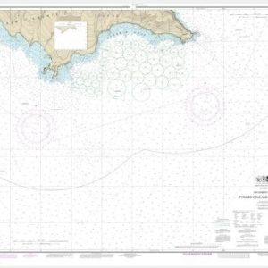
  • San Clemente Island Pyramid Cove and approaches (chart 18764)

    $21.00
    Select options
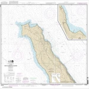
  • San Clemente lsland northern part;Wilson Cove (chart 18763)

    $21.00
    Select options
  • San Diego Bay (chart 18773)

    $21.00
    Select options
  • San Diego to Cape Mendocino (chart 18020)

    $21.00
    Select options
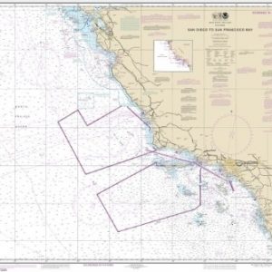
  • San Diego to San Francisco Bay (chart 18022)

    $21.00
    Select options
  • San Diego to Santa Rosa Island (chart 18740)

    $21.00
    Select options
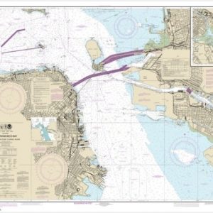
  • San Francisco Bay Candlestick Point to Angel Island (chart 18650)

    $21.00
    Select options
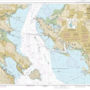
  • San Francisco Bay-Angel Island to Point San Pedro (chart 18653)

    $21.00
    Select options
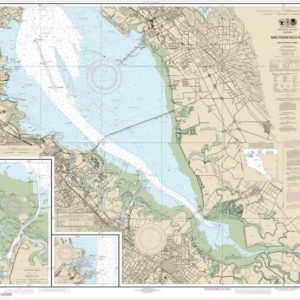
  • San Francisco Bay-southern part;Redwood Creek.;Oyster Point (chart 18651)

    $21.00
    Select options
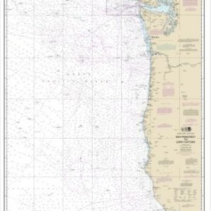
  • San Francisco to Cape Flattery (chart 18007)

    $21.00
    Select options
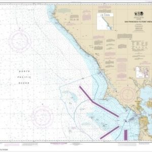
  • San Francisco to Point Arena (chart 18640)

    $21.00
    Select options
  • San Joaquin River Stockton Deep Water Channel Antioch to Medford Island (chart 18660)

    $21.00
    Select options
  • ←
  • 1
  • 2
  • 3
  • …
  • 11
  • 12
  • 13
  • 14
  • 15
  • 16
  • 17
  • 18
  • →

Chartside Map Locators

Looking for a specific nautical chart?

Download these helpful chartside indexes to find the chart you're looking for quickly.

Regions

  • Alaska
  • Atlantic
  • Pacific
  • Great Lakes
  • Gulf

(all chartside files are PDF format and are very large, be patient during download on slow connections)

Contact Us

Feel free to contact us if you have any questions.

  • 8119 Central Ave.
    Capitol Heights, MD 20743
  • HBudd@whmap.com
  • 301-336-1143
  • 800-338-6228
  • 301-336-5520
  • http://whmap.com/

Map Production

We have the staff, software and equipment to handle all aspects of cartography and map production. Our large library of software titles can accommodate the processing and editing of any customer-provided final files.

We are also able to create new maps by utilizing files output from a GIS environment, integrating such data with accompanying text and graphics (photographs, logos, street indexes, tables, etc.) into a clean, publication-quality layout.

Long Term

Williams & Heintz Map Corporation has been printing maps for entrepreneurs, government agencies, and map publishers for over 93 years. We combine the highest quality pre-press, printing, and folding with industry leading knowledge and customer service.

Sustainable

Williams & Heintz understands the importance of building and maintaining a cleaner environment and aims to contribute in as many ways possible throughout our map production and printing cycle.

We are continuously improving elements in our map making and printing process to produce the same high quality custom maps with far less negative impact on the environment.

Versatile

At Williams & Heintz, we can assist you with any aspect of map production and manufacturing, from the simplest 1-color map to the most complicated 12-color map, from 3″ x 5″ to 47 ¼ ” x 63″. Send us your digital files, or films and camera copy.

We welcome your difficult reproduction problems and complex technical maps as well as simpler jobs. All will get the same care and attention to detail that maps require, at a competitive price.

  • facebook
  • twitter
  • google plus
  • Linkedin
  • youtube
© 2022 Williams & Heintz Map Corporation. All Rights Reserved.

Web Design by Solnet