• facebook
  • twitter
  • google plus
  • Linkedin
  • youtube
Orders over $100 ship FREE 800-338-6228
NOAA Charts
$0.00 0
  • Home
  • Shop for nautical charts
  • Customer Login
  • Show Cart

Category: Atlantic

  • Home
  • Shop for nautical charts
  • Products
  • Atlantic
  • Page 3
Home / Shop for nautical charts / Atlantic / Page 3

Atlantic

Showing 25–36 of 256 results

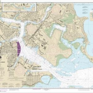
  • Boston Harbor (chart 13270)

    $21.00
    Select options
  • Boston Inner Harbor (chart 13272)

    $21.00
    Select options
  • Buzzards Bay; Quicks Hole (chart 13230)

    $21.00
    Select options
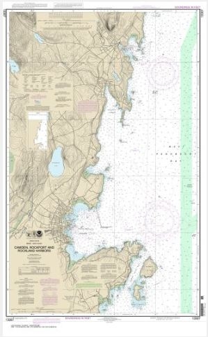
  • Camden, Rockport and Rockland Harbors (chart 13307)

    $21.00
    Select options
  • Campobello Island (Metric);Eastport Harbor (chart 13396)

    $21.00
    Select options
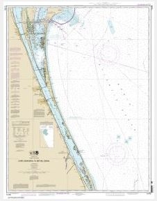
  • Cape Canaveral to Bethel Shoal (chart 11476)

    $21.00
    Select options
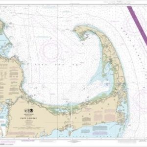
  • Cape Cod Bay (chart 13246)

    $21.00
    Select options
  • Cape Cod Canal and Approaches (chart 13236)

    $21.00
    Select options
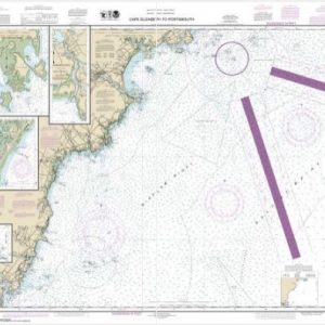
  • Cape Elizabeth to Portsmouth; Cape Porpoise Harbor; Wells Harbor; Kennebunk River; Perkins Cove (chart 13286)

    $21.00
    Select options
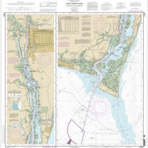
  • Cape Fear River Cape Fear to Wilmington (chart 11537)

    $21.00
    Select options
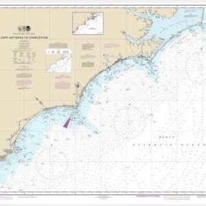
  • Cape Hatteras to Charleston (chart 11520)

    $21.00
    Select options
  • Cape Hatteras to Straits of Florida (chart 11009)

    $21.00
    Select options
  • ←
  • 1
  • 2
  • 3
  • 4
  • 5
  • 6
  • …
  • 20
  • 21
  • 22
  • →

Chartside Map Locators

Looking for a specific nautical chart?

Download these helpful chartside indexes to find the chart you're looking for quickly.

Regions

  • Alaska
  • Atlantic
  • Pacific
  • Great Lakes
  • Gulf

(all chartside files are PDF format and are very large, be patient during download on slow connections)

Contact Us

Feel free to contact us if you have any questions.

  • 8119 Central Ave.
    Capitol Heights, MD 20743
  • HBudd@whmap.com
  • 301-336-1143
  • 800-338-6228
  • 301-336-5520
  • http://whmap.com/

Map Production

We have the staff, software and equipment to handle all aspects of cartography and map production. Our large library of software titles can accommodate the processing and editing of any customer-provided final files.

We are also able to create new maps by utilizing files output from a GIS environment, integrating such data with accompanying text and graphics (photographs, logos, street indexes, tables, etc.) into a clean, publication-quality layout.

Long Term

Williams & Heintz Map Corporation has been printing maps for entrepreneurs, government agencies, and map publishers for over 93 years. We combine the highest quality pre-press, printing, and folding with industry leading knowledge and customer service.

Sustainable

Williams & Heintz understands the importance of building and maintaining a cleaner environment and aims to contribute in as many ways possible throughout our map production and printing cycle.

We are continuously improving elements in our map making and printing process to produce the same high quality custom maps with far less negative impact on the environment.

Versatile

At Williams & Heintz, we can assist you with any aspect of map production and manufacturing, from the simplest 1-color map to the most complicated 12-color map, from 3″ x 5″ to 47 ¼ ” x 63″. Send us your digital files, or films and camera copy.

We welcome your difficult reproduction problems and complex technical maps as well as simpler jobs. All will get the same care and attention to detail that maps require, at a competitive price.

  • facebook
  • twitter
  • google plus
  • Linkedin
  • youtube
© 2022 Williams & Heintz Map Corporation. All Rights Reserved.

Web Design by Solnet